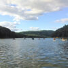
New Map of PA Watershed Organizations Available
POWR has created an interactive GIS-based map of Pennsylvania’s known community watershed organizations (CWOs), watershed alliances and coalitions, and other organizations whose missions include water resource conservation, restoration, and education. We believe the potential applications of this tool include the ability to connect CWOs with potential regional partners for small- and large-scale restoration projects; identification of volunteer opportunities with local CWOs for interested local residents; and the evaluation of potential new strategic alliances and as well as the location of ‘gaps’ on the landscape where efforts to engage new organizations may benefit regional water resource protection efforts.
View the Map and please email POWR if you do not see your CWO mapped or if the service area identified for your organization does match your actual area of impact and effort in the landscape. If you have additional corrections or questions, please contact us with those as well.
A few tips for using the map:
Zooming:
Zoom in and out via either your mouse wheel or by clicking the + and – icons on the left of the map screen.
Toggle between basemaps:
Users can change the basemap via the icon that is just below the zoom buttons.
Layers:
You can turn layers on and off in the “Legend” tab to the left of the map.
Selecting features:
When you click on an area of the map, any watershed organizations or other “features” in that area will become highlighted in blue. The information about the selected feature is displayed on the left panel of the map under the “Info” tab. If the location you clicked contains more than one feature (note: layers must be on to be selectable), you can toggle between them using the arrows at the top right of the “Info” tab.
Search Function:
Users can search for features in various layers, as well as locations, via the magnifying glass icon in the top right of the map. The drop down menu at the left of the search bar allows user to select which layer is being searched. Only one can be selected, or select “all.”
Please note that this map is a work in progress and we are still quality checking information, working on making it more user-friendly and adding more information.
Technical Assistance for Local Watershed Implementation: NFWF Field Liaison Support Available
If you are interested in accessing free technical assistance from NFWF for Bay-related restoration work click HERE